If there’s one must-have skill every hiker and camper should learn, it’s how to read a map. Arming yourself with this knowledge not only reduces the risk of getting lost, but also makes navigating from A to B much safer, stress-free…
…and much less likely to land you at point Z somewhere between the two!
In recent years, many hikers have chosen to forego paper maps in favor of apps and GPS devices. These tools are easy to use and marvels of convenience. However, they’re also susceptible to mechanical failure, signal loss, water damage, and, of course, battery death.
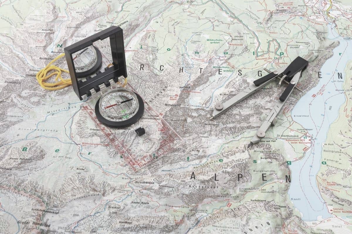
As such, the humble, tried-and-true topo paper map remains your most reliable tool for backcountry navigation.
That’s the good news.
The better news is this: adding this knowledge to your armory of outdoor smarts is easy to do. After that, a little bit of practice is all it takes to turn yourself from a navigational apprentice into a navigational pro!
Dos
- Note the scale to measure the correct distances
- Check the revision date of a map
- Always carry compass
- Practice reading a map before hitting the wilds
Don’ts
- Use a road map for hiking
- Forget to orient the map before taking readings
- Forget to adjust for magnetic declination
Want to read maps like a master?
- Know the different kinds of maps available
- Identify the various parts of a map
- Understand how to use a map in different situations
- Learn how to read coordinates
Types of Maps
Topographic Map
The first map on our list is the type typically used by hikers and mountaineers.
Topographic maps (aka “topos”) show the many physical features of an area, including the elevation, landmarks, bodies of water, settlements, and boundaries of national/state parks or reserves.
A topo map also offers a 3-dimensional representation of the terrain. It does so through the use of contour lines, which show elevation changes throughout the landscape covered. The detail included in topographic maps makes them ideal for hiking, fishing, skiing, surveying, and anyone else who needs to navigate with accuracy in backcountry terrain.
Road Map
True to its name, the road map focuses primarily on roads and transportation links. The majority of the lines on these maps represent minor and major highways. Major roads are typically depicted in bold.
Road maps also show cities, attractions, and monuments, but offer less detail than tourist maps, a fraction of the detail of topos, and should never be used for backcountry navigation.
Tourist Map
Tourist maps are easy-to-read navigational instruments that anyone can follow. These maps are laid out more simplistically, emphasizing tourist attractions and popular landmarks. Most, however, are not to scale and offer no indication of changes in elevation, thus making them all but useless for navigating in the wild.
The 5 Essential Parts of a Map
Title
All maps feature a title offering a brief description of what the map covers. In short, it contains the what, where, and when—what it depicts, where the area depicted is located, and the date of its last revision.
Legend
Usually found in the bottom corner of the sheet, the legend is a decoder of all the symbols and lines used on the map. It also includes important information like the source data, the area’s magnetic declination, the contour interval, and the color key.
Scale
A map’s scale explains the relationship between real-world distances and distances depicted in the map. It is usually located in both the legend and on the cover and reveals the ratio of map inches or centimeters to inches or centimeters in the terrain.
For example, a scale of 1:50 000 simply denotes that every 1 inch/cm on the map represents 50,000 inches (0.79 miles) or centimeters (0.31 miles) in the terrain, depending on the unit of measurement used.
Grid Lines
The series of horizontal and vertical lines printed on your map are called the grid lines. They help identify locations using coordinates and are used with your compass’s orienting lines when taking bearings. Grid lines are used in both topo and road maps.
Compass Rose
Finally, a map isn’t complete without its classic identification of the four cardinal directions – north, south, east, and west (N, S, E, and W). The symbol which does so is known, in topographical parlance, as the compass rose.
This feature is almost always found in the legend, and its north arrow always points to the top of the map. The compass rose in many maps will also show you the difference between grid north (the North Pole) and magnetic north, which helps you, above all, in adjusting for magnetic declination.
How to Read a Map
Reading Map Coordinates
There are two types of topo maps generally used for hiking: latitudinal/longitudinal maps and UTM maps.
Latitudinal/Longitudinal Maps
Geographical coordinates define the latitude and longitude of a specific point. Longitudinal lines run north to south, while latitudinal lines run east to west. Both sets of lines allow us to give coordinates for any spot, anywhere on the planet.
Latitudes and longitude are measured in degrees and are written latitude first, longitude second. For more precision, the degrees are divided into minutes, and the minutes divided into seconds. Thus, you have coordinates like 43° 03’ 42.6” N (43 degrees, 03 minutes, and 42.6 seconds).
To establish your coordinates, first mark the exact spot of your destination on your map. Then look at the numbers on the edges of the map. These are called graticules and provide the coordinates of each grid line on the map. Latitude graticules are marked on the east-west edges while the longitude ones are on the north-south edges.
Your latitude is identified by drawing an imaginary horizontal line from your point of destination towards the nearest edge of the map. Do the same for the longitude mark. Only this time, draw the line vertically. Combining the two readings will provide you with your coordinates, which should look something like 37°51’54” N (for latitude), 119°32’18” W (for longitude).
UTM Maps
Universal Transverse Mercator (UTM) maps were devised by the US Army in the 1940s as a means of simplifying land navigation. In recent years, the UTM system has become more popular than the latitude/longitude system for land navigation owing to its ease of use.
The UTM grid system divides the world into 60 individual “zones” in each hemisphere. The zones each measure 6° longitude wide and are numbered 1 to 60, starting from 180° longitude and proceeding eastward around the globe. Each longitudinal zone is divided by lines that point toward true north, thus creating a total of 120 zones worldwide.
Each zone is used as a basis for providing/reading coordinates. Unlike latitudinal/longitudinal maps, however, the distances represented in UTM maps are metric and are not given in degrees.
As such, the ordering of UTM coordinates may look like this: 11S 705428m E 4344683m N.
In this example, “11S” refers to the grid zone covered by the topo you’re using. 705428m E identifies, in meters, your east-west position (aka “easting”) within the specific grid zone. 4344683m N identifies your north-south position (aka “northing”) within the specific grid zone.
As with latitude/longitude maps, UTM coordinates are read using the easting (or latitude) first and the northing (longitude) second. A common ditty to help you remember to read the map coordinates correctly is “you go in your house (easting) before going up the stairs (northing)”.
Contour Lines & Understanding Topography
One of the most important distinguishing features between topo and other map types is the use of contour lines.
These squiggly lines connect points on a map that share the same elevation, meaning they allow you to easily gauge the shape of any terrain and identify prominent features with just a quick glance at your map.
Changes in elevation are represented by variations in the spacing of the lines. This means that lines that are tightly packed together indicate steep terrain, whereas those that are more spaced out indicate flatter, gentler terrain.
Typically every fifth contour line is thicker and includes a numerical elevation marker. These are called “index lines”.
Understanding contour lines is useful for several reasons. It can help you plot the easiest course (aka “countouring“), gauge timing more accurately, and avoid potential hazards like cliffs and steep slopes.
Locating Yourself
Finding your whereabouts in any landscape is easily done when you pair your map up with its age-old accomplice, the compass.
Start by identifying landmarks on your map and then trying to find these landmarks in the actual terrain. Landmarks to look out for are easily identifiable ones like switchbacks, outcrops, waterfalls, river bends, or the edge of a forest.
Next, point your compass’s direction of travel arrow towards the landmark. Rotate the bezel of the compass housing until the orienting arrow is aligned with your compass’s (usually red) magnetic needle. Now, read the bearing from the “index pointer”. This is the line at the top of the housing and base of the direction of travel arrow.
Next, place the compass on your map and align the orienting lines inside the housing with the map’s north-south grid lines while keeping one edge of your compass over the identified landmark. The point where the compass edge crosses your route is your current location.
Plotting a Course
Plotting a course with a map is easier than it sounds. It’s just a matter of charting the best route from your starting point to your destination using a series of intermediary waypoints, just like connecting the dots.
This skill is especially useful when navigation in poor visibility as it allows you to establish a course that will steer you well clear of hazards. At other times, it lets you choose the “path of least resistance” by avoiding steeper inclines, river crossings, or any other features that might make life tricky.
Start by putting your compass on the map. Place the straight edge of the compass baseplate along a line between waypoint A and waypoint B and draw a line between the two points on your map for reference.
Next, take a note of the bearing on which you’ll need to travel from A to B. Do this by turning the bezel until the compass needle is inside the orienting arrow and reading the bearing at the index line above the housing.
Finally, repeat this process for each leg of your route. And if you want to go into more detail, you can also measure the distance of each leg of your course by referring to your map’s scale and using your compass ruler.
Where to Find the Best Maps
For phones and GPS devices, we recommend the apps or downloadable maps from ViewRanger, AllTrails, MapOut, and OSMaps.
For paper maps, the options also abound. If you can’t find the map needed for your trip on Amazon, REI, or through the USGS website, your best bet is to contact local stores in the area where you plan on doing your hiking.
Map Reading? Done!
Did we say “done”?
Before venturing into the wilds, we recommend honing your new map-reading skills in a familiar area. That way, you’ll gain confidence and feel more comfortable when the time comes to branch out.
Also, the more you familiarize yourself with reading maps, the better you’ll get at it. With just a little bit of patience and perseverance, you’ll soon be navigating like a pro!
If you enjoyed this article or have any comments on how to map read more effectively, please feel free to share your thoughts with us in the box below. And if you’d like to share it with your friends, share away!